
Snow forecast for Staffordshire and North Wales hills as West Midlands and Shropshire brace for weather change

Snow warning as colder conditions threaten North Wales and Staffordshire after frosty start
Residents across the West Midlands, Shropshire and Staffordshire can expect a change in weather this weekend, with sunshine giving way to rain and increasingly unsettled conditions.
After several cold nights brought widespread frost across parts of the UK, forecasters are predicting a brief spell of brighter weather before rain and stronger winds arrive on Sunday.
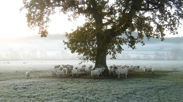
The Met Office says Saturday (November 14) will begin on a frosty note across the West Midlands, with freezing conditions in some areas before temperatures gradually recover.


Shrewsbury, Telford, Wolverhampton, Birmingham and surrounding areas can expect a largely dry day, with sunny spells breaking through the cloud. Temperatures are forecast to reach around 7C to 8C.
Staffordshire residents can also look forward to some sunshine on Saturday, although it will remain chilly, particularly during the morning. Stafford is forecast to reach around 7C, with clear spells allowing temperatures to fall again overnight.
However, the brighter conditions are not expected to last throughout the weekend.
Rain and strong winds set to hit West Midlands
Sunday is expected to bring a noticeable change, with cloud increasing and outbreaks of rain moving across the region.
The Met Office is forecasting a cloudy and breezy day, with some showers potentially becoming heavy. Temperatures could reach around 8C to 10C in parts of the West Midlands, although strong gusts may make conditions feel colder.
In Shropshire, including Shrewsbury, Oswestry and Bridgnorth, Sunday is also expected to turn increasingly cloudy, with rain developing during the day.
Staffordshire could see similar conditions, with rain arriving during the morning in some locations and potentially becoming heavier later.
Snow possible across North Wales and Staffordshire hills
There could also be a wintry element to the changing weather, particularly over higher ground.
The Met Office has indicated the potential for hill snow in northern parts of the UK, while its regional outlook for Wales suggests hill snow could develop overnight into Monday as colder conditions return.
Higher ground across North Wales, including parts of Snowdonia, could therefore see some wintry weather.
There is also the possibility of snow over higher hills in Staffordshire, particularly as rain moves through and temperatures fall overnight on Monday.
However, there is currently no indication of widespread snowfall across lower-lying towns and cities, with any snow risk more likely to affect elevated areas.
What happens next?
Monday is expected to bring another change, with colder and brighter conditions developing during the morning.
The Met Office says rain could arrive later in the day before turning to snow over hills overnight.
Showery conditions are then expected to continue into Tuesday, followed by another spell of colder weather.
Residents across the West Midlands, Shropshire and Staffordshire are therefore being advised to prepare for a mixed spell of weather, with frosty mornings, brighter intervals, rain and the possibility of wintry conditions over higher ground.
The latest forecasts should be checked for updates as the weekend progresses, particularly for those travelling through rural and higher parts of North Wales and Staffordshire.
A cold weather alert issued this week for the West Midlands ended at midday on Saturday.