Will there be thunder in Birmingham today? Map of thunderstorms in England after UK heatwave

and live on Freeview channel 276
The Met Office has issued a yellow thunderstorm warning for parts of the UK, including certain parts of Birmingham.
This comes after most of the UK saw areas under amber and red weather warnings for extreme heat on Monday 18 July and Tuesday 19 July.
Advertisement
Hide AdAdvertisement
Hide AdSo what will the yellow weather warning look like in Birmingham?


Here’s everything you need to know about the current forecast.
What has the Met Office said?
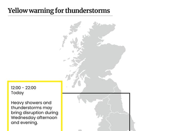
The Met Office has stated that parts of Birmingham can expect: “heavy showers and thunderstorms may bring disruption during Wednesday afternoon and evening”.
The weather warning is in place from 12pm on Wednesday 20 July and will last until 10pm in the evening.
Advertisement
Hide AdAdvertisement
Hide AdWhat does the yellow weather warning mean for Birmingham?
Yellow warnings from the Met Office can cover a broad range of conditions, so whenever a warning is issued the Met Office also releases a breakdown of what the affected areas can expect.
Here’s what the Met Office has said about the current Yellow warning in place and the affected parts of Birmingham can expect:
- Spray and sudden flooding could lead to difficult driving conditions and some road closures.
- Where flooding or lightning strikes occur, there is a chance of delays and some cancellations to train and bus services
- There is a slight chance that power cuts could occur and other services to some homes and businesses could be lost
What is the forecast for today?
It is a cloudy start for the West Midlands this morning with the odd shower breaking through.
Throughout the afternoon there will be sunny spells across the region, and the conditions will feel fresher than the beginning of the week.
Temperatures will hit highs of 25°C.
Advertisement
Hide AdAdvertisement
Hide AdThe evening will be cloudy across the northern parts of the region with some sunny spells breaking through.
Throughout the night more clouds will develop and increase the risk of showers.
Temperatures will hit lows of 14°C.
What is the forecast for the rest of the week?
Thursday
Thursday will continue to be rather cloudy with the best bright spells breaking through in the western areas of the region There will be a continued risk of isolated shows in some places.
Maximum temperatures will be 22°C.
Outlook for Friday to Sunday
This period will be dry and bright with showery rain likely on Friday and Saturday.
Advertisement
Hide AdAdvertisement
Hide AdTemperatures will be close to normal but feel warm in the sunshine.
Rain will arrive on Sunday.
How to stay safe in thunder and lighting?
The Met Office has an extensive breakdown of what to do before, during and after a thunderstorm.
You can find the full breakdown of advice on the Met Office website.
Here are a few key pieces of information and advice to take into consideration when navigating through the yellow warning in place for Birmingham:
- If outside avoid water and find a low-lying open place that is a safe distance from trees, poles or metal objects
- Avoid activities such as golf, rod fishing or boating on a lake
- Be aware of metal objects that can conduct or attract lightning, including golf clubs, golf buggies, fishing rods, umbrellas, motorbikes, bicycles, wheelchairs, mobility scooters, pushchairs, wire fencing and rails. If you are in a tent, try to stay away from the metal poles
- Avoid downed power lines or broken cables
- Be aware that current can travel through other parts of many modern cars, including GPS and radio systems. Cars with metal interior handles, foot pedals and steering wheels can also carry current
- Keep your speed down, lowering your speed will lower the distance you travel when buffeted around by the wind.
Comment Guidelines
National World encourages reader discussion on our stories. User feedback, insights and back-and-forth exchanges add a rich layer of context to reporting. Please review our Community Guidelines before commenting.