Storm Babet in Birmingham: Rain, thunder and floods expected

and live on Freeview channel 276
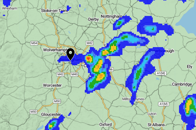
Heavy rain, thunder and floods are expected in the West Midlands, including Birmingham today (Thursday, October 19).
The Met Office has issued a Red warning in some parts of the UK as Storm Babet will bring exceptional rainfall and impactful wind.
Advertisement
Hide AdAdvertisement
Hide AdThe Met office said flooding is expected in some parts of the West Midlands, including Birmingham. The Environment Agency issued a flood warning for the Bourn at Bournville including Wood Brook.
The Environment Agency said: “Flooding is expected in this area. This means properties are at risk of flooding.
“Please take action to protect yourself and your property and monitor local weather and river conditions. Avoid contact with, walking or driving through flood water. Consider activating any property flood protection products you may have.
“Environment Agency Flood Warning Officers set the river or tidal levels that have triggered this message. During industrial action this message has been automatically issued based on rising river or tidal levels.”
Advertisement
Hide AdAdvertisement
Hide AdThe agency added that flooding is also possible in River Rea and River Cole.

Rain and thunder expected in Birmingham
Birmingham is also set to be lashed with rain and thunder from 3pm today (Thursday, October 19), according to the Met Office. It will be a grey start with sunny intervals in the morning, but heavy showers will develop through the afternoon. It could bring the risk of thunder at times before dying down into the evening. Maximum temperature today will be 18 °C with precipation expected between 70% and less than 5%.
Tonight, light winds and widespread fog is expected across the region. It will remain mostly dry and feeling mild. Minimum temperature 11 °C.
On Friday, early fog will clear quickly as winds increase with a band of rain sweeping in from the southeast. It will remain wet through the day but also feeling cooler than previous days. Maximum temperature 14 °C.
Outlook for Saturday to Monday:
Advertisement
Hide AdAdvertisement
Hide AdRain will linger through Saturday with a risk of hill fog. Rain will start to ease and it will begin clearing through Sunday and into Monday but will feel colder.
National Highways advice to motorists in the Midlands
Motorists are being advised to plan ahead for their journeys with the imminent arrival of Storm Babet and an increased risk of floods.
The Met Office warnings are for between midnight tonight (Thursday, October 19) and 6am on Saturday (October 21), and affect the North West and North East of England, Yorkshire and Humber and the East and West Midlands.
Dale Hipkiss, National Network Manager at National Highways said: “Driving conditions are likely to change when Storm Babet arrives this week. If you’re using the roads slow down and give yourself more space between you and the vehicle in front. It is harder for tyres to grip the road and excess spray makes it harder to see ahead.
Advertisement
Hide AdAdvertisement
Hide Ad“We also remind drivers to remember TRIP – this is a National Highways initiative to help motorists. It stands for: Top-up - fuel, water and oil; Rest - every two hours; Inspect - tyres and lights before a long journey and Prepare - check your journey and the weather forecast before heading out.”
National Highways has produced online guidance on its website to handling different weather conditions when weather gets colder in an effort to keep road users as safe as possible on its motorways and A-roads.
While rain is frequent throughout the year, it is particularly common over the autumn and winter months, with the possibility of floods, slippery road surfaces and reduced visibility for drivers.
In heavy rain, drivers should keep well back from the vehicle in front, gradually ease off the accelerator if the steering becomes unresponsive, and slow down if the rain and spray from vehicles makes it difficult to see and be seen.
Advertisement
Hide AdAdvertisement
Hide AdThere are lots more travel tips, vehicle checks and useful motoring advice for negotiating severe weather on the National Highways website, to help improve driver confidence when travelling as temperatures get colder, the nights draw in and the potential for fog, rain and high winds increase.
Avoid the floods
Don’t drive through flood water: there could be hidden hazards, and it may be deeper than it looks.
Top tips
The following advice will help you stay safe when driving in wet weather:
- If it’s time for your wipers, it’s time to slow down
- Use dipped headlights, especially if visibility is seriously reduced
- The roads will be more slippery than usual, so give yourself more time to react - increase the gap between you and the vehicle in front to at least four seconds
- Look out for standing water - adjust your driving before and after encountering any
- Always keep your eyes on the road - spray from other vehicles can suddenly reduce your visibility
- Visibility affects others too, so anticipate their actions and be prepared
- During thunderstorms, sudden winds can unsettle vehicles - keep your speed down and give other road users more room
Comment Guidelines
National World encourages reader discussion on our stories. User feedback, insights and back-and-forth exchanges add a rich layer of context to reporting. Please review our Community Guidelines before commenting.