Floods hit Birmingham amid heavy rain - full list of Environment Agency alerts & rail disruption

and live on Freeview channel 276
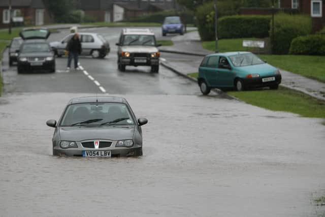
The Environment Agency has issued five flood warnings and nine flood alerts, urging people to take action and avoid low-lying roads and paths. The warning is in place until 6pm on Thursday, February 22. There has also been disruption on rail services in Birmingham and across the West Midlands.
Where are the flood warnings in Birmingham?
Flood warnings, which mean flooding is expected and immediate action is required, have been issued for the following waterways:
Advertisement
Hide AdAdvertisement
Hide AdBourn Brook at Selly Oak: There is a possibility of flooding along Bournbrook Road, Harborne Lane, and Bristol Road.
Illey Brook at Halesowen: There is a possibility of flooding near Illey Lane and Manor Way.
Lutley Gutter at Halesowen: There is a possibility of flooding near Lutley Lane and Stourbridge Road.
River Blythe at Blyth End::There is a possibility of flooding near Blyth End Bridge and Coleshill Road.
The Bourn at Bournville: :There is a possibility of flooding along Bournville Lane and Mary Vale Road.
River Dene, near Wellesbourne: There is a possibility of flooding near Walton Road and Charlecote Road.
River Avon at Strensham and at Wyre Piddle: There is a possibility of flooding along Strensham Mill and Wyre Mill and affecting properties and roads near Mill Lane and Pershore Bridge.
Gog Brook at Warwick: There is a possibility of flooding along Warwick Racecourse and affecting properties and roads near Hampton Road and Stratford Road.
Marchington Brook at Marchington::There is a possibility of flooding along Marchington Industrial Estate affecting properties and roads near Stubby Lane and Uttoxeter Road.
River Blithe near Blithfield Reservoir:There is a possibility of flooding along Blithfield Reservoir affecting properties and roads near Blithfield Hall and Admaston.
Brimfield Brook at Orleton:There is a possibility of flooding along Orleton Village affecting properties and roads near Millbrook Way and Ludlow Road

Which areas are under flood alerts?
Flood alerts, which mean flooding is possible and people should be prepared, have been issued for the following waterways:
Middle Tame: The river is high and could cause flooding of low-lying land and roads near Tamworth, Sutton Coldfield, and Birmingham city centre. The river level may rise further with more rainfall expected.
River Arrow and River Alne: The rivers are high and could cause flooding of low-lying land and roads near Alcester, Studley, and Henley-in-Arden. The rivers may continue to rise with more rain forecast.
River Blythe in Warwickshire: The river is high and could cause flooding of low-lying land and roads near Solihull, Hampton-in-Arden, and Balsall Common. The river level may increase with further rainfall expected.
River Cole: The river is high and could cause flooding of low-lying land and roads near Coleshill, Chelmsley Wood, and Sheldon. The river level may rise further with more rain forecast.
River Rea: The river is high and could cause flooding of low-lying land and roads near Northfield, Stirchley, and Birmingham city centre. The river level may increase with further rainfall expected.
River Salwarpe: The river is high and could cause flooding of low-lying land and roads near Droitwich Spa, Bromsgrove, and Redditch. The river level may rise further with more rain forecast.
River Stour and Smestow Brook in the Black Country and South Staffordshire: The river and the brook are high and could cause flooding of low-lying land and roads near Stourbridge, Dudley, Wolverhampton, and Wombourne. The water levels may increase with further rainfall expected.
Upper Tame: The river is high and could cause flooding of low-lying land and roads near Walsall, West Bromwich, and Tipton. The river level may rise further with more rain forecast.
Upper Tame at Sandwell Valley: The river is high and could cause flooding of low-lying land and roads near Sandwell Valley Country Park and Forge Mill Lake. The river level may increase with further rainfall expected.
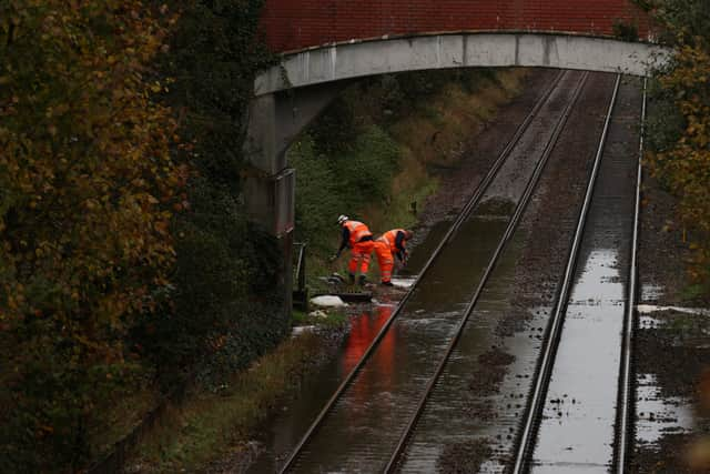
How are the floods affecting rail services?
Floods are disrupting rail services in the West Midlands, with the Met Office warning of further rain across the region. Trains through Warwickshire, Telford, Worcester and Wolverhampton are all affected.
West Midlands Trains said routes between Oakengates and Wellington, and Worcester and Dorridge were blocked, with buses running instead.
CrossCountry has also cancelled routes running from Birmingham New Street to Cheltenham Spa, with journeys between Worcester Foregate Street and Hereford also affected.
Advertisement
Hide AdAdvertisement
Hide AdPassengers are advised to check their travel plans before setting off and to allow extra time for their journeys.
Advice for residents
The Environment Agency has advised residents to stay away from swollen rivers and not to drive or walk through flood water, as it could be dangerous. People should also check their flood risk, sign up for flood warnings, and prepare a flood plan. For more information: Environment Agency.
The Met Office has issued a yellow weather warning for rain, which means there is a chance of travel disruption and flooding. For more information: Met Office.
Comment Guidelines
National World encourages reader discussion on our stories. User feedback, insights and back-and-forth exchanges add a rich layer of context to reporting. Please review our Community Guidelines before commenting.